

Research Project
Creating High-Resolution Soil Maps for NCAAR for Precision Soil-Water Management
Investigators: Amanda J. Ashworth
Date: 2022
Project Summary
Background and Goals
Digital soil property maps are being created for the West Farm to develop precision soil and water management recommendations to improve water quantity and quality in the Lower Mississippi Delta. Soil maps are created from digital elevation models, terrain attributes, and remote sensing and help illustrate the spatial distribution of soil properties for every 5 square meters (16 x 16 ft). This digital soil mapping method (patented by ARS scientists) is currently being used on 1.5 M acres in 16 states within the U.S. This mapping algorithm uniquely predicts continuous soil properties and groups these properties into patterns within the field that have similar response to fertilizer and herbicide applications within crop varieties. Use of this technology reduces operating costs by 8-12% and saves producers $25-$50/ac. However, because this mapping process is largely terrain-driven, little work has been to evaluate its application in flat and topographically homogeneous areas like the Mississippi Delta. SWMRU Scientists will also further using these continuous soil property maps as a data layer to evaluate potential aquifer recharge areas, reduce over-irrigation, and more precisely manage soil nutrients, thus improving surface water quality.
Methodology
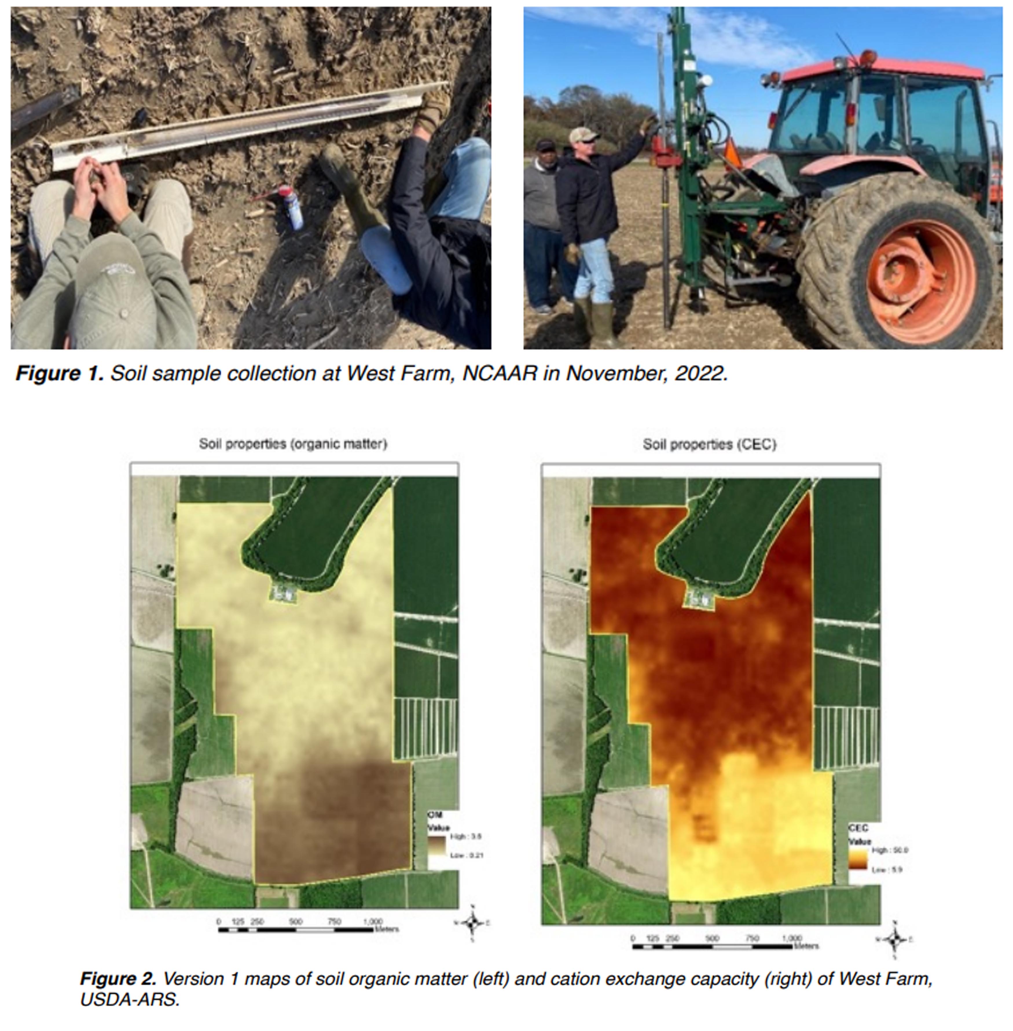
These soil property maps illustrate continuous soil property predictions for improved agricultural management. In general, maps are created by: (1) disaggregating Gridded Soil Survey Geographic Database (SSURGO) to develop a parent material map; (2) then, a 3-m resolution light detection and ranging (LiDAR)-based digital elevation model (DEM) is developed to determine terrain attributes and resampled to 5 m resolution; (3) followed by k-means clustering to develop generic soil classes developed within each PM; and, (4) fuzzy logic is then carried out to develop unique property predictions for each pixel within the area. From there a "smart sampling" campaign was undertaken to sample unique soil classes, thus minimizing sample numbers (Figure 1). For the 250 acre West Farm, 16 sample cores were collected to 90-120 cm (0-15; 15-30; 30-60; 60-90; 90- 120). By applying a fuzzy logic model (patented by an ARS scientist) on soil sample points, USDA-ARS has produced geospatial property maps that estimate soil properties of alluvial soils in Mississippi.
Outcomes of Soil Mapping Products
- Allow producers and researchers to make real-time precision management decisions in the field using high resolution soil information.
- Respond to landscape-level agricultural issues that ultimately improved our understanding of spatial variability and related nutrient and water-use efficiency (Figure 2).
- Develop a mapping method for heterogeneous alluvial soil systems for broader use in the Mississippi Delta.
- Managing soil to manage water (focus on infiltration and recharge).
References
For more information on methodology please visit:
Fuentes, B. A.J. Ashworth, M. Ngunjiri, and P.R. Owens. 2021. Mapping soil properties to advance the state of spatial soil information for greater food security on US Tribal Lands. Frontiers in Soil Science. 1, 95386. doi.org/10.3389/fsoil.2021.695386
Smith, H.W., A.J. Ashworth, and P.R. Owens. 2022. GIS-based evaluation of soil suitability for optimized production on U.S. Tribal Lands. Agriculture. 12(9), 1307. https:// www.mdpi.com/2077-0472/12/9/1307
Project Photos
- Topic:
- Soil
- Irrigation
Find Research
By Crop Type
By Topic
Contact NCAAR
General Information
Kaye Sullivan
vfs23@msstate.edu
662.390.8510
F:662.390.8501
Showcase Demo
Drew Gholson, Coordinator
drew.gholson@msstate.edu
662.390.8505
Himmy Lo
himmy.lo@msstate.edu
662.390.8509